Radiological Measurement
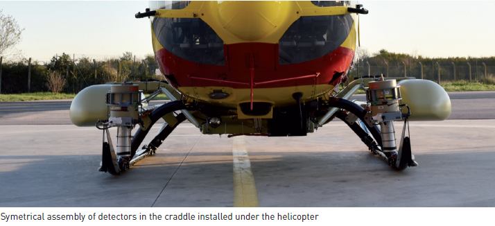
HELINUC (Airborne Gamma Spectrometry System)
Description - Missions
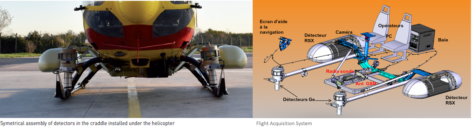
Mission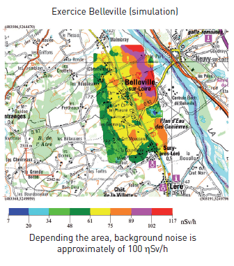
This helicopter embarked apparatus allows for quick cartography of gamma-ray emitting radio-isotopes
on large contaminated areas by :
- Creating a map of Gamma radioactivity over large areas of land
- Detecting and identifying radionuclides
- Evaluating surface contamination or ground-level dose rate
- Detecting, pinpointing and identifying punctual sources
GAMMA TRACERS
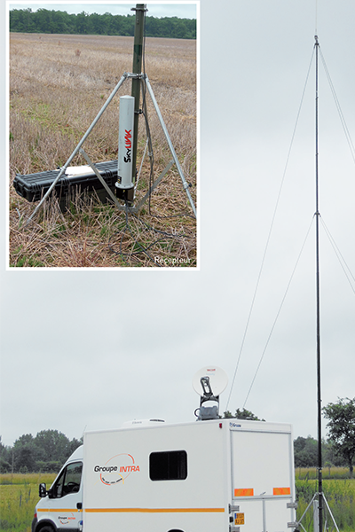
Depending on the accident kinetics, tracers can be placed as a preventive measure - before radiation release- to obtain continuous feedback during the release phase, or can be set up to monitor a specific location, or else to mlonitor a specific area's radiological evaolution.
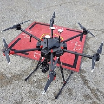
The tracer probes installation occurs when radiological conditions allow human personnel to do so, or in the contrary, by outdoor robots or even by UAVs..
Interface
Data processing consists in tracer probes' dose rates real time acquisition and positioning on a geographical map with respect to coordinates. Readings are transmitted to the installation operator and to Nuclear Radioprotection and Safety Institute (IRSN) which embed them into their general radiological surveillance map. This map, displaying last values transmitted and historic data, is available on Groupe INTRA's web site via a secured access..
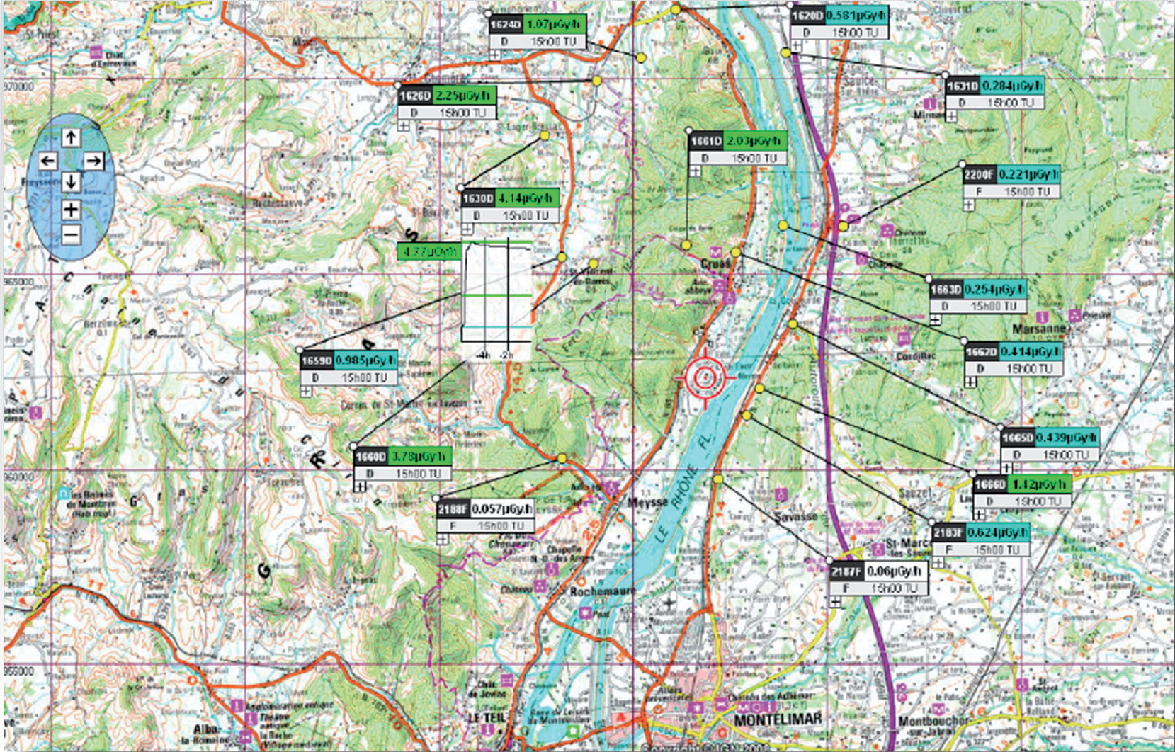
Map with tracers lay out and data rendition
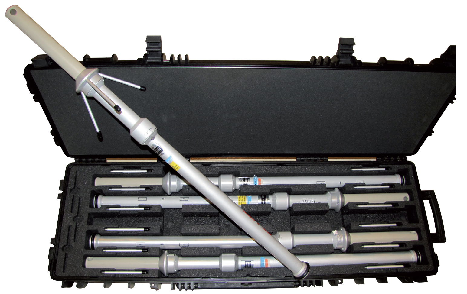
Tracers packaged for transport
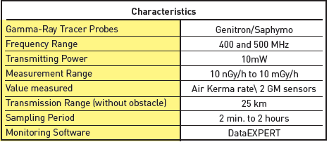
Available data
- Real time gamma dose rate
- Real time map displays of tracers' readings
- Historic data for any tracer